su gentile concessione di
VALLEY OF THE GODS
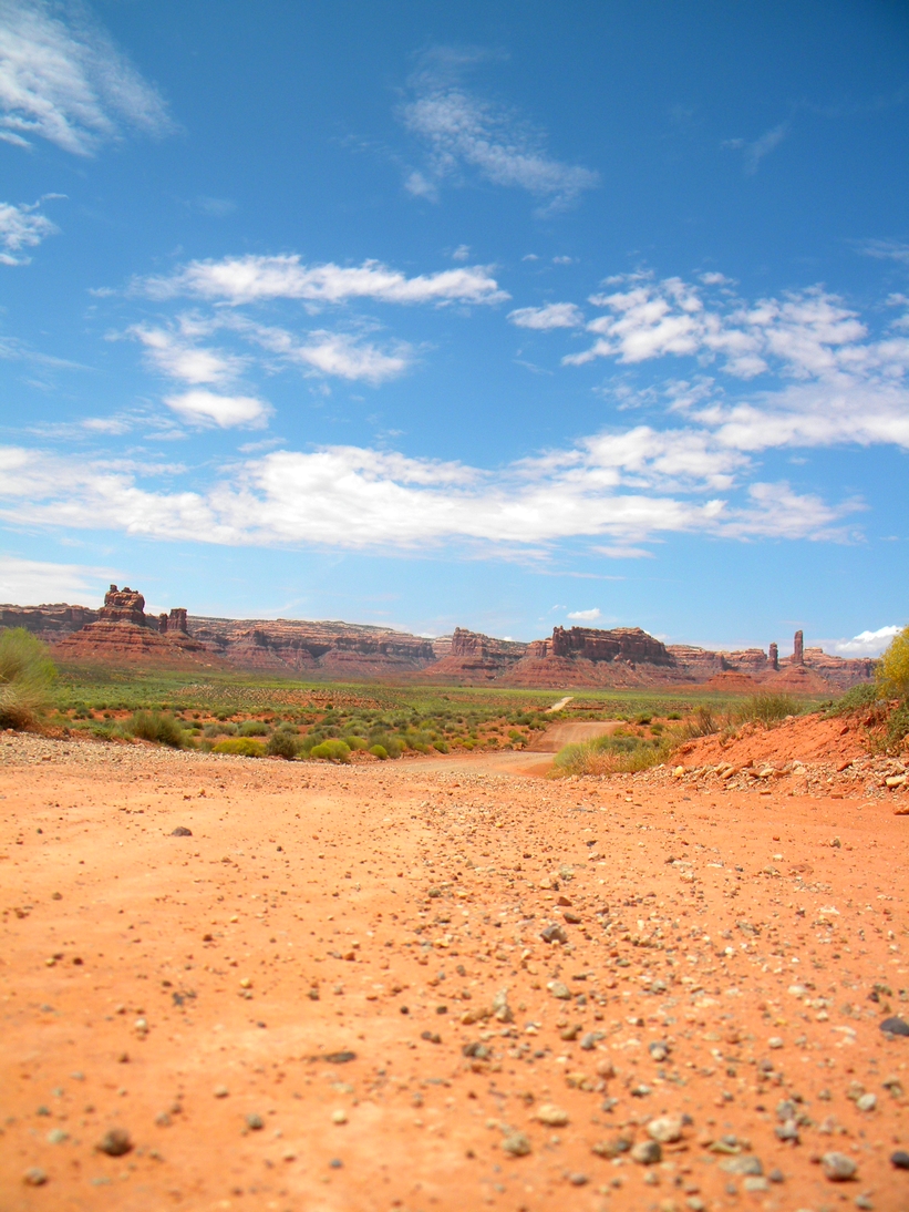
Valley of the Gods is toured via a 17-mile, unpaved loop. The east entrance is accessed off US-163 approximately 15 miles west of Bluff. The west entrance is accessed of US-261. The 17-mile loop is unpaved, but the graded gravel and clay surface road is suitable for cars when the road is dry. The road has a few sharp turns and crosses several washes. Valley of the Gods is maintained by the Bureau of Land Management (BLM), Monticello Field Office, Monticello, Utah. Telephone: 435-587-1500. (fee 20$)
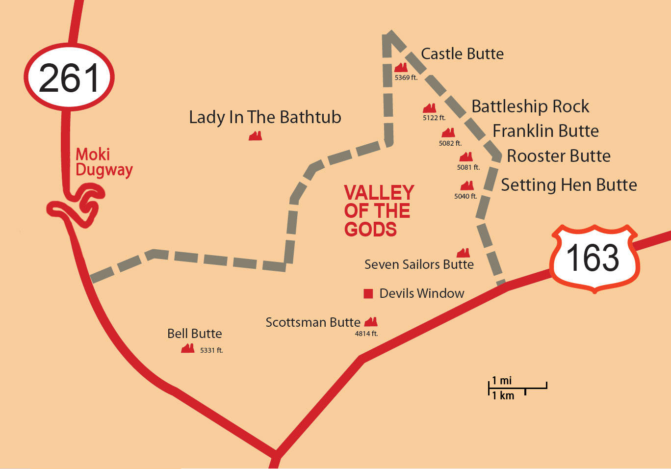
| 0.5 miles | Scenic pull off. The SEVEN SAILORS formation is on your left (west). The SEVEN SAILORS appear to have flat sailor caps. |
| 1.5 miles | SETTING HEN BUTTE can be viewed straight in front of you. |
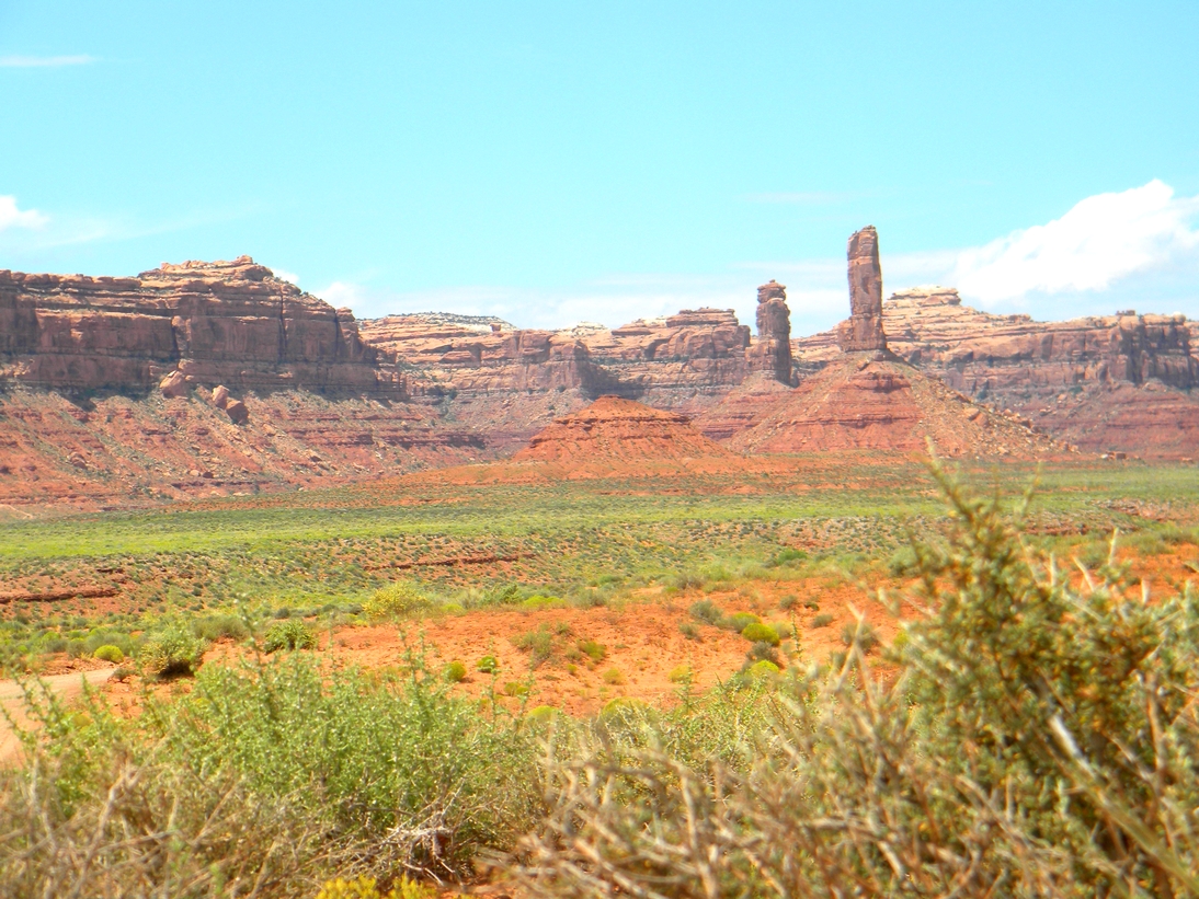
| 5 miles | BATTLESHIP ROCK is on your left (southwest). |
| 5.7 miles | If you pull over at this point, look in your rear view mirror. The ROOSTER BUTTE, a monolith, will be visible to the south. |
| 7 miles | At this point, you begin to circle CASTLE BUTTE on your left. |
| 8 miles | The drive around CASTLE BUTTE is complete. |
| 15.5 miles | VALLEY OF THE GODS BED AND BREAKFAST/LEE’S RANCH is at this point. |
| 16 miles | You have reached Utah Highway 261. Turn left to go to the Goosenecks State Park, US 163, Mexican Hat and Monument Valley. Turn right to go up the Moki Dugway, and access Muley Point and Cedar Mesa. Utah Highway 95 is also to the right, which leads you to Natural Bridges National Monument. |